
ASSESSING INFORMATION- LAST UPDATED 07-31-2018
Parcel ID: 16A-26-H52
Assessors' Card
53 is now on its own.

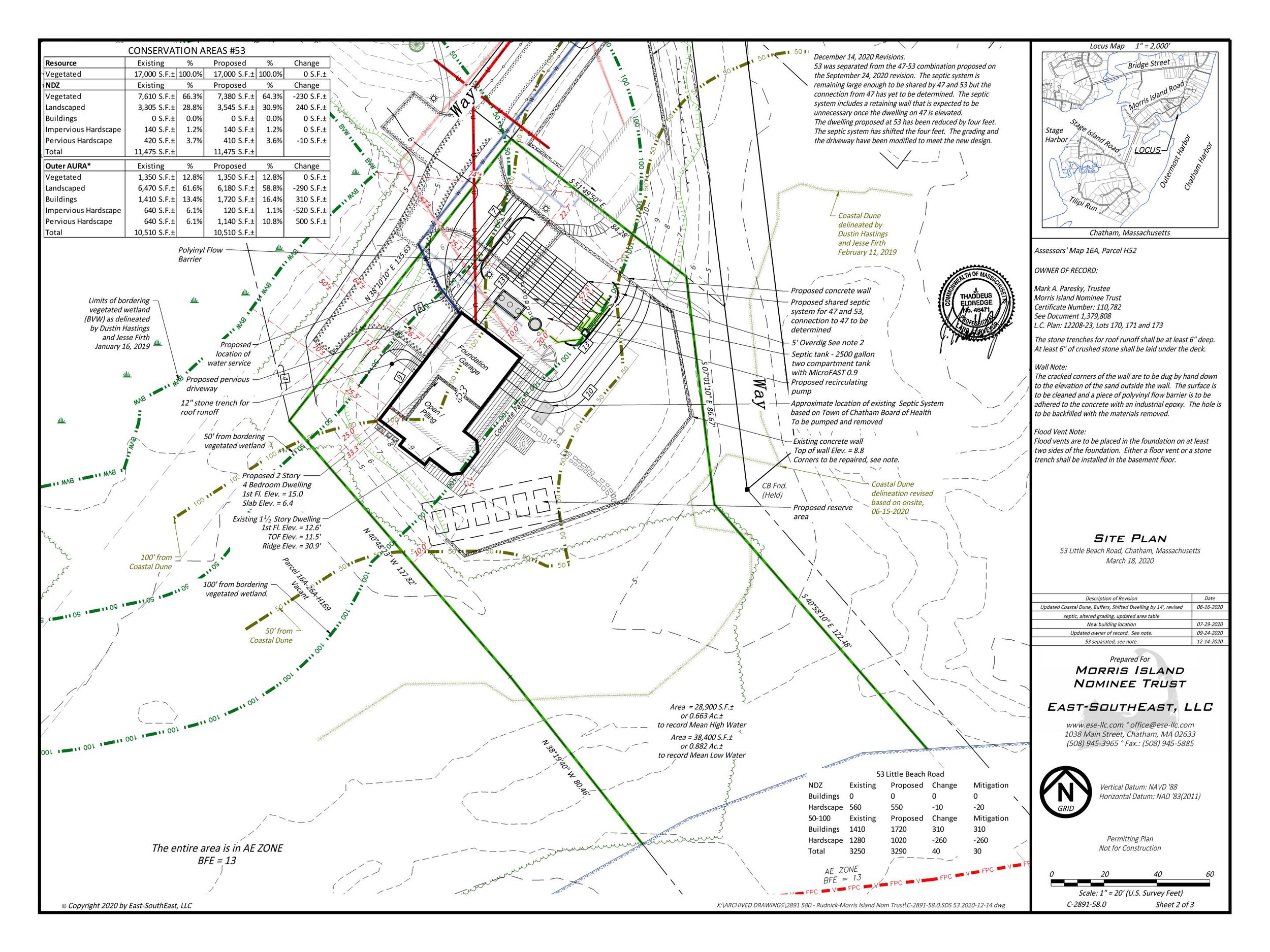

The filings are now merged 47+53


Revised Plans


An aGIS map is available for this property. Click the image for the sales page or HERE for more information.